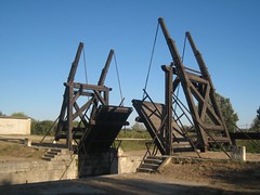

Vincent Van Gogh spent his final years in this little town called Arles. There’s lots of scenes around town that he painted, like the one above, the Langlois Bridge. Looks just like it, right? We had this lovely view all to ourselves and got to enjoy art in real life without another tourist in sight. How did we get so lucky? Well, the tourist office gives you a nice little map of town that includes all the Roman ruins as well as the Van Gogh sites that looks like this:
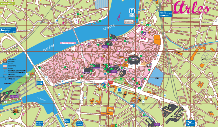
The inset map is located right below it:
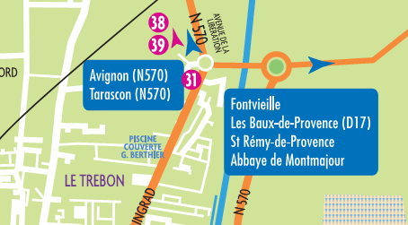
I cropped some things out but it is very clear that the bottom map is a blowup of one of the main areas of the bigger map. So we arelooking for #38, Van Gogh’s bridge. Should be in the North right? Let’s drive on N570 towards Avignon just like the map tells us. Lets drive around, and around and around until someone tells us….no Van Gogh’s Bridge is in the south. Excuse moi Monseiur, this map clearly shows it is located in the North. “Oh no, can’t you see, they didn’t have room for #38 and #39 on the big map, so rather than placing them geographically where they belong, they decided to pretend like that section of the little map was still part of the big map and just overlay it like it was still in the south of the big map even though it now really appears to be in the north of the little map. That little pink arrow obviously indicates that those sites are meant to be in the map above. Makes sense, no?” You have to be kidding me.
We spent the next half hour discussing the logic behind the decision to make the map this way, convinced that we couldn’t be the first people to see the absurdity in it until we finally found the bridge. Not another soul in sight. I guess they were all up North driving around, and around, and around.
ahahha!!! never question the french logic!